
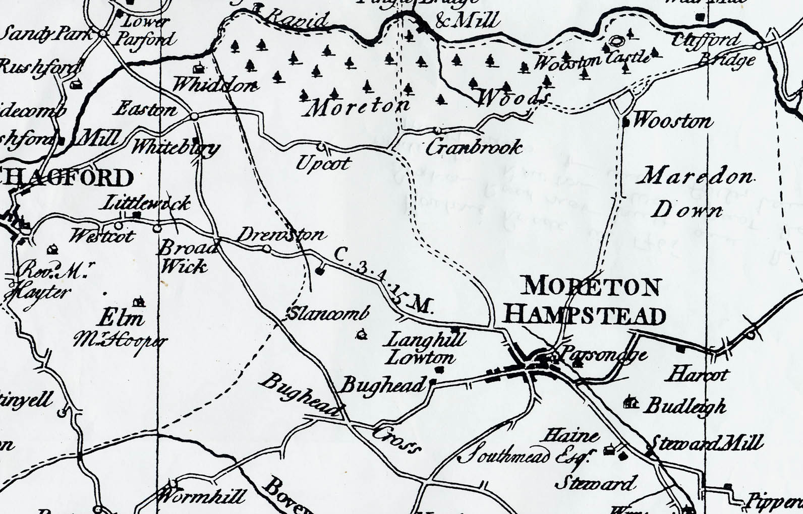
1. Donn’s map, 1765:
In the eighteenth century the Society for the Encouragement of the Arts sought to encourage one inch to the mile maps to be made for all the counties. Benjamin Donn produced a county map for Devon in 1765. Previous county maps, such as those by Christopher Saxton and John Speed, were not as detailed. Donn’s shows principal roads and gentlemen’s seats, as well as settlements and some natural features, such as woods. This is an image of the area of the parish.
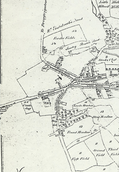
2. Survey of the manor, 1790:
This survey of the Manor of Moretonhampstead made in 1790 for the Lord of the Manor, Lord Courtenay, shows the manor lands. The whole document (in the Devon Record Office) covers several sheets. Our picture is an enlargement of the town centre area and, though not very clear, shows the absence of our Station Road and New Cut and the presence of various market buildings. The block containing the White Horse and White Hart is continuous with the south side of Cross Street.
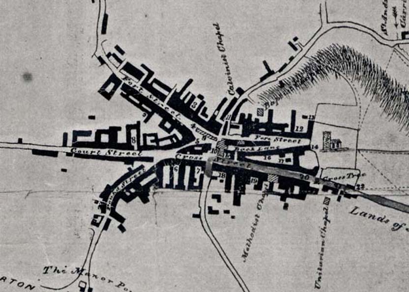
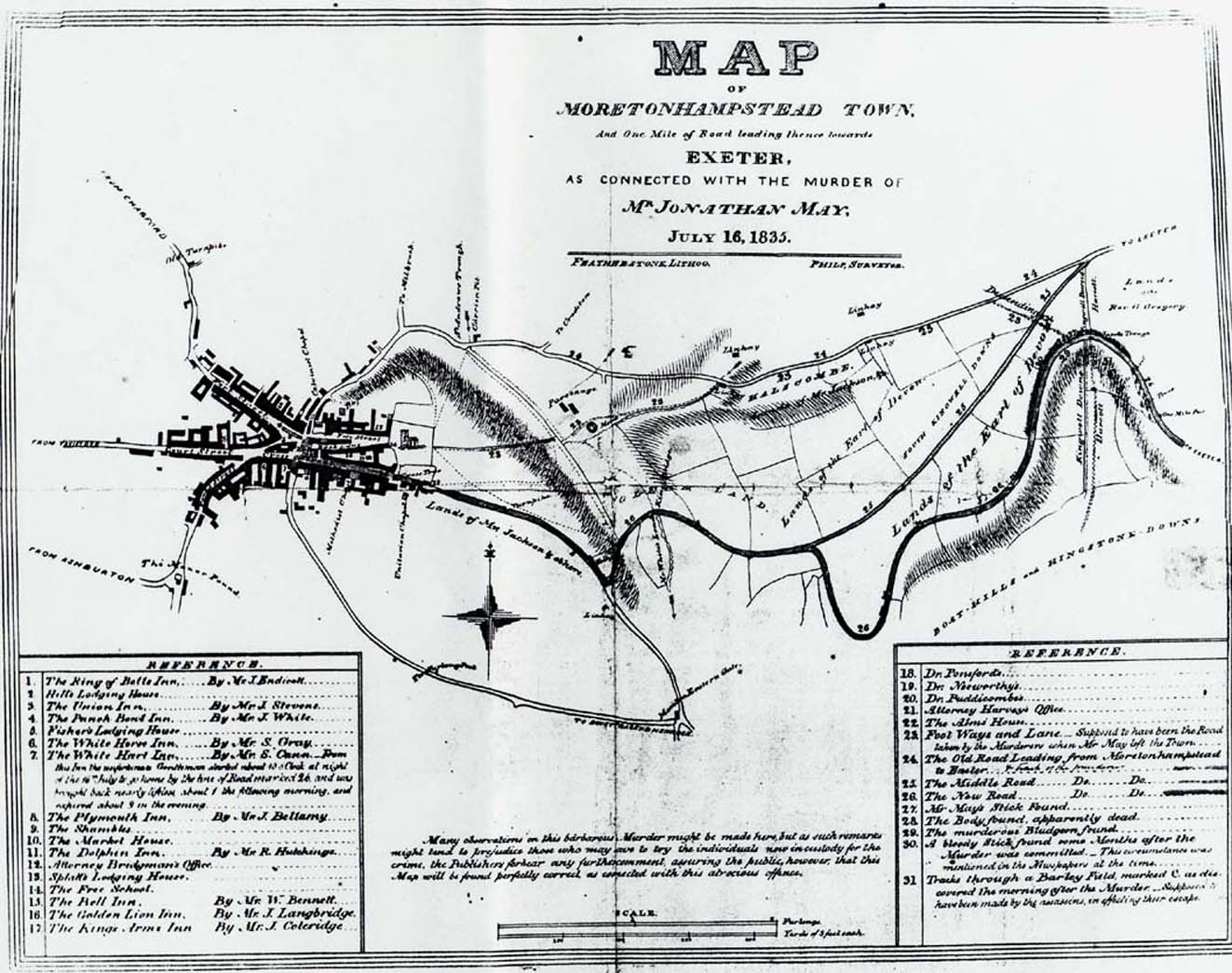
3. Map of the town, 1835 (town centre section):
This map was produced for the trial of the supposed murderers of Jonathan May, so that the court could follow the evidence. It is useful because it shows the town centre on a fairly large scale before the big fire in 1845 destroyed a lot of property between Greenhill and Cross Street and led to the formation of the New Cut. It also marks several inns and the houses of the doctors concerned in the story. Our copy was taken from one hanging on the wall of the White Hart Hotel, by kind permission of Peter Morgan, a former landlord. The present Station Road shows up as a lane. You can see the whole map here. You can see clearly how the old market buildings blocked the end of Back Lane and filled the top of Ford Street. As the key to the map is not easy to read and contains valuable information about the inns at the time, the text of the map key is shown below.
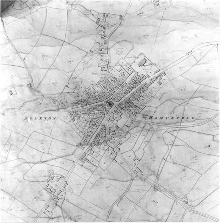
4. Moretonhampstead Tithe Map, 1840:
Tithe maps were produced in the 1830s and 1840s for much of the country, in the wake of the Tithe Commutation Act (1837). They are a valuable source of information about ownership of land and the size of properties, but the tithe map for Moreton is very large. The copy in the Devon Record Office consists of two large sheets which are a bit grubby and obscured by lettering. This photograph relates to the part around the town centre. Look particularly at Court Street and the buildings at “Court”. (bottom left), and the buildings down by Millbrook in the opposite direction.
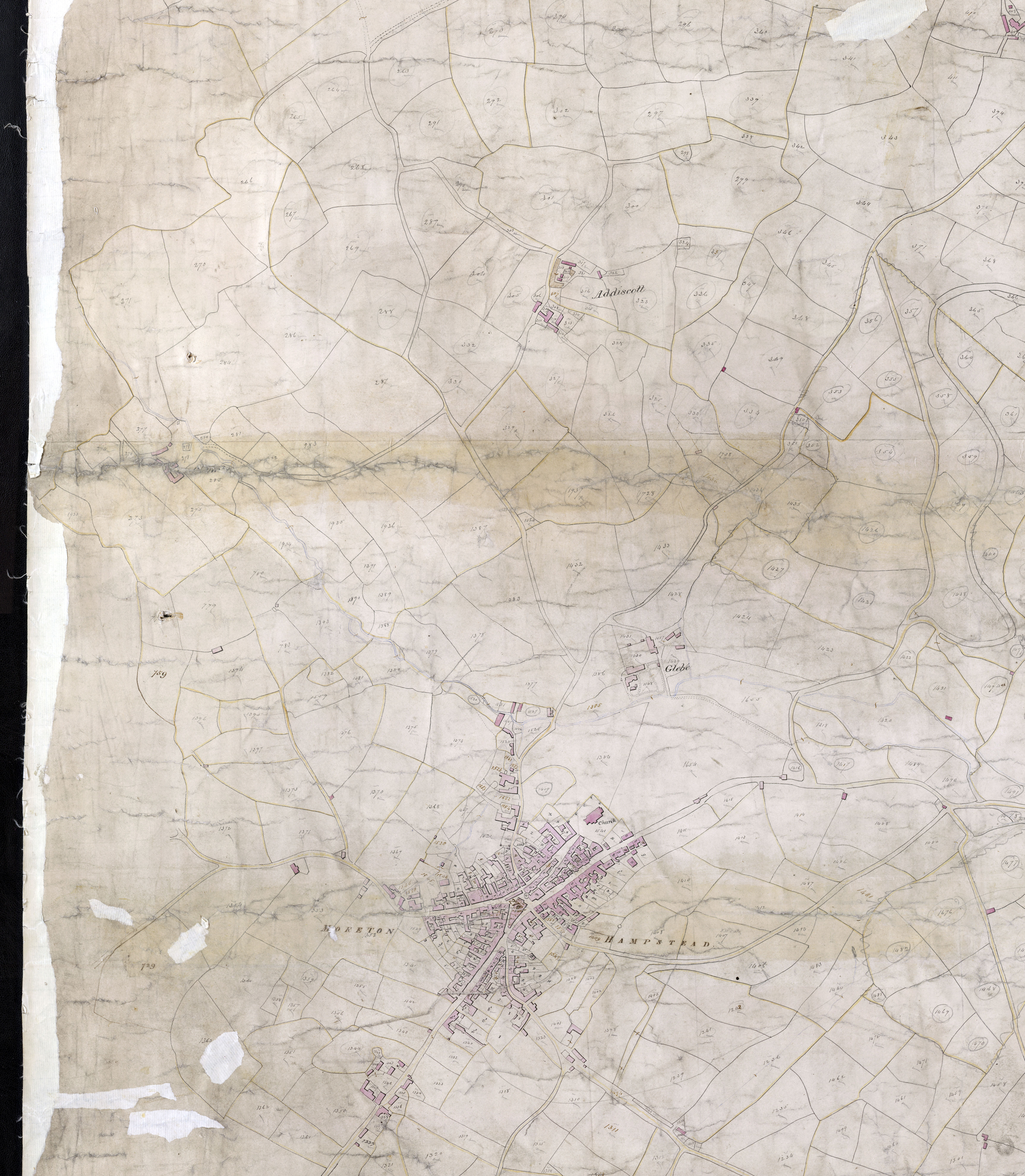
5. Moretonhampstead Tithe Map, 1840 – larger map
This is a larger version of the Moretonhampstead tithe map.
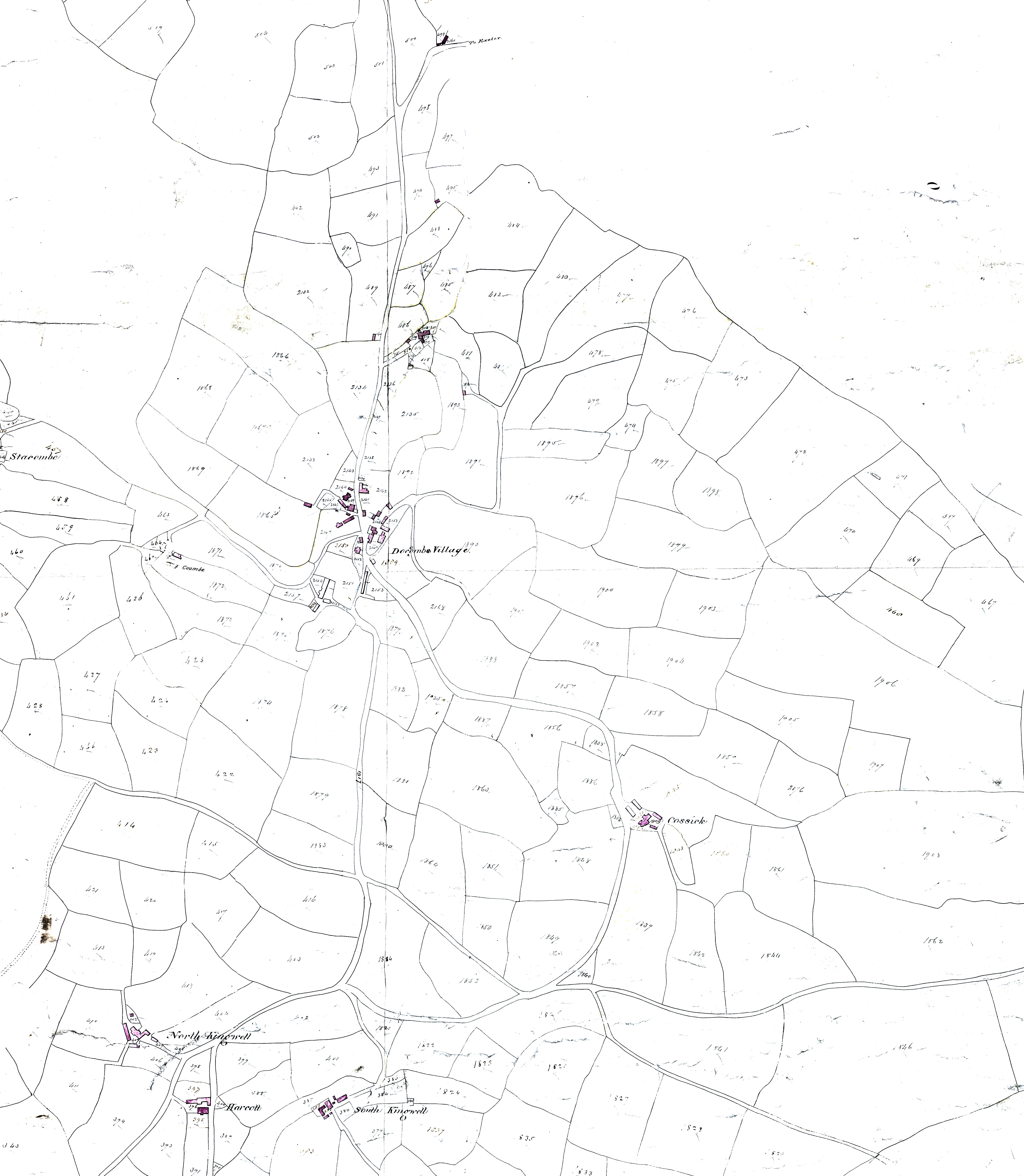
6. Doccombe Tithe Map, 1840:
Tithe maps were produced in the 1830s and 1840s for much of the country, in the wake of the Tithe Commutation Act (1837). They are a valuable source of information about ownership of land and the size of properties.
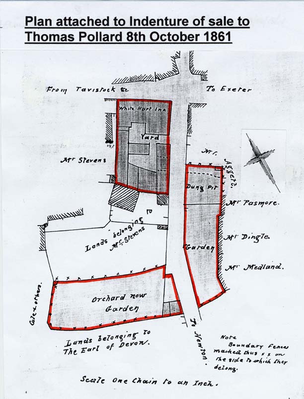
7. White Hart, 1861:
A very clear map of the inn’s premises at the time of sale to Thomas Pollard.
- 1. The Ring of Bells Inn – Mr J. Endicott
- 2. Hill’s lodging house
- 3. The Union Inn – Mr J. Stevens
- 4. The Punch Bowl Inn – Mr. J. White
- 5. Fisher’s lodging house
- 6. The White Horse Inn – Mr S. Gray
- 7. The White Hart Inn – from this Inn the unfortunate gentleman started about 10 o’clock at night of the 16th July to go home by the line of road marked 26 and was brought back nearly lifeless about 1 the following morning and expired about 9 in the evening.
- 8. The Plymouth Inn – Mr J. Ballamy
- 9. The Shambles
- 10. The Market House
- 11. The Dolphin Inn – Mr R. Hutchings
- 12. Attorney Bridgman?s office
- 13. Splatt’s Lodging House
- 14. The Free School
- 15. The Bell Inn – Mr W. Bennett
- 16. The Golden Lion Inn – Mr J. Langbridge
- 17. The King’s Arms Inn – Mr J. Coleridge
- 18. Dr Ponsfords
- 19. Dr Nosworthys
- 20 Dr Puddicombes
- 21. Attorney Harvey’s office
- 22. The Alms House
- 23. Foot Ways and Lane. Supposed to have been the road taken by the murderers when Mr May left the Town
- 24. The Old Road Leading from Moretonhampstead to Exeter
- 25. The Middle Road do. do.
- 26. The New Road do. do.
- 27. Mr May’s stick found
- 28. The Body found, apparently dead
- 29. The murderous Bludgeon found
- 30. A bloody stick found some months after the murder was committed.
- 31. Tracks through a Barley field marked C, as discovered the morning after the Murder, supposed to have been made by the assassins in effecting their escape.